
The Center of Caribbean Life
Puerto Rico is surprising. Its unique character was invented by its people and its history. It preserves its flavor from the days of the pirates and is a small center of Caribbean life that was invented with the arrival of the Spaniards.
Borinquen Island was inhabited by the Tainos. When Christopher Columbus discovered it he called it San Juan Bautista. It was then, with the arrival of Europeans and Africans, that the mixture of races started, creating a society that today vibrates to the rhythm of salsa. The island, which is 60 km (37 mi) wide and 130 km (81 mi) wide, was created by a series of volcanic eruptions that formed its central mountain range, an authentic spinal column that divides it in two and is dominated by the Cerro de Punta (13,38 m / 43,90 ft). In the northern part of the island, the Atlantic lashes the coasts, its beaches and cliffs. The southern coast is on the Caribbean.
To discover this beautiful, enchanting island, we set sail on a six-day voyage to a veritable tropical garden, with some marvelous marinas along the way.
Through Beautiful San Juan
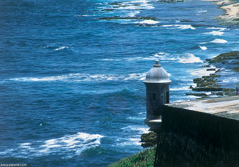
San Juan, with its fabulous marina located within an immense bay, is the starting point for sailing west. The walls of Old San Juan glow and the iron balconies tell tales of those strong winds that beat against the island.
The people talk about the legends of the sea, when the waves are high, when the Spanish galleons arrived or when the big cruise ships pull into the port.
Between 1511 and 1521, under the leadership of conqueror Juan Ponce de León, the city was established on this island to protect it from the attacks of the Tainos. The wall was built and soon the Spanish Crown constructed the imposing San Felipe El Morro Fort, with 50 m (164 ft) thick walls, atop the cliff at the entrance to the bay.
The intriguing San Cristóbal fort was built in 1634 by the Irish mercenary Alejandro O’Reilly, who invented some tunnels to connect it to the adjacent forts. At that time, San Juan was one of the most protected cities in the New World. In 1595 it was able to survive and repel the attacks of the pirate Sir Francis Drake.
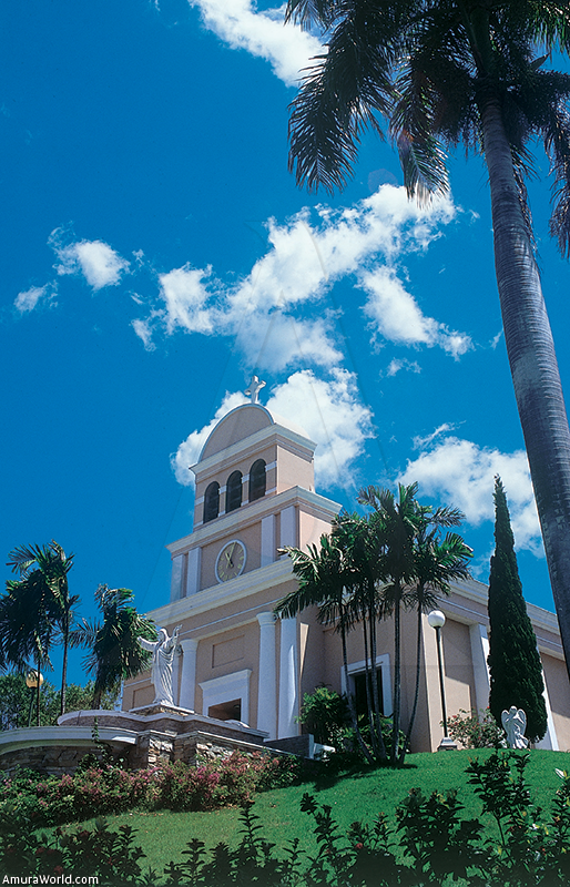
Today it is a marvelous area where, as you walk along the narrow streets, amidst colorful houses, visiting its cathedral, churches and convents, the theaters, the small plazas and the famous San Juan Gate, you feel the flavor of the past.
La Fortaleza (The Fort), built in 1533, protects that side where those ships dropped anchor. La Capilla de Cristo (Chapel of Christ) and Casa Blanca (White House)—home of the Ponce de León family for 250 years—, preserve the charm of the past, as does the huge Quinto Centenario plaza, which is framed by the Dominican convent, the Cuartel Balajá (Balajá Barracks), and the former Carmelite convent, which has been converted into a grand hotel. Old San Juan, an authentic relic of the past, is a wonderful place for a colorful stroll through an important urban center that extends inland and along the east coast, where hotels and buildings border the beaches.
Along the Atlantic Coast Route
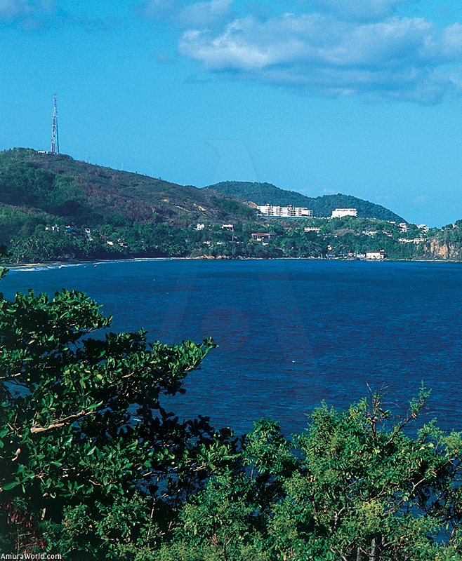
We set sail westward, following the Atlantic Coast, a string of long, white sand beaches, with bays separated by low cliffs. A flat coast, with a few lagoons and lots of vegetation, borders the lowlands at the foot of the central mountain range.
Dorado is a great tourist destination, with big resorts located along the beach. Passing Cerro Gordo point, we come upon Playa Tortuguero (Tortuguero Beach), protected by the lagoon of the same name, which was the former paradise of manatees and now is home to caimans.
The empty beaches continue until we arrive in Arecibo, a large port city where we anchor in order to visit the impressive observatory with its receptor set amidst the rocky mountains, and the Camuy River caves, in the middle of a Karstic landscape.
Arecibo is not an especially attractive city and we set sail very early, the following day. We began at the small village of Isabela and punta Sardina (Sardina Point) following the beautiful beaches where surfing is one of the most popular sports.
There are ideal spots like Playa Jobos (Jobos Beach), protected by a coral reef, which was the site of the World Surfing Competition in 1989; Playa Shacks, at the foot of Ramey Base, with some beautiful caves for diving, and other beaches with long strings of dunes and white sand.
Passing Punta Borinquen (Borinquen Point), with its ochre cliff lashed by the winds and the waves, protecting beautiful Playa Wilderness (Wilderness Beach), we arrive at Playa Crash Boat (Crash Boat Beach,) in the La Mona pass, that marks the division between the Atlantic and the Caribbean and separates Puerto Rico from the Dominican Republic, with La Mona island 50 miles from the coast.
Crash Boat, with crystalline waters, is one of the most beautiful beaches on the island, a true paradise where we dropped anchor and enjoyed its charm.
Along the West Coast
We follow our route south, passing Aguadilla Bay, home to a big city with lots of traffic and hotels set along the shore. An active port where there are cranes, the abandoned Ramey Military Base, now serving as a city for low income families, long beaches separated by cliffs that shelter small inlets and a coral reef at the edge of the sand.
History tells us that it is this beautiful coast is where Columbus first saw the island. To the north and to the south of Punta Higuera (Higuera Point), where the lighthouse is located, the beaches are famous for surfing and are especially popular for swimming.
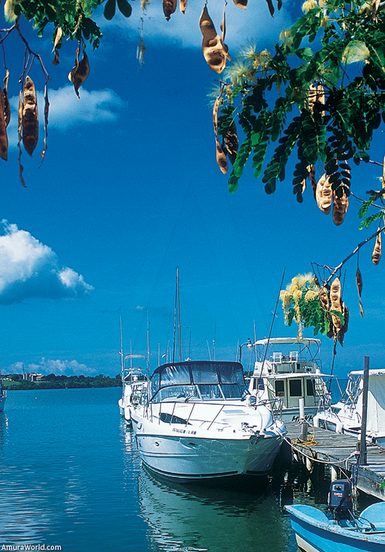
Rincón, a small town with an excellent marina, is one of the best places to enjoy the fine sand beaches, calm waters and hotels. This is where we finally dropped anchor.
We arrived at the Hotel Horned Dorset, one of the most exclusive in Puerto Rico. From the rooms, with their private swimming pool, you can look out over the sea from the heights of a small cliff. Its restaurant is the most famous on the whole island.
The west coast is framed by a calm sea, a series of lagoons, mangroves and tranquil bays that are ideal for dropping anchor. There are excellent marinas. We toured Bahía de Añasco (Añasco Bay) and its long beach that frames green lowlands that stretch out along the foot of the central mountain range, inhabited by Mayagüez, a noisy city with an important port, some old homes dating from the 19th century and a theater.
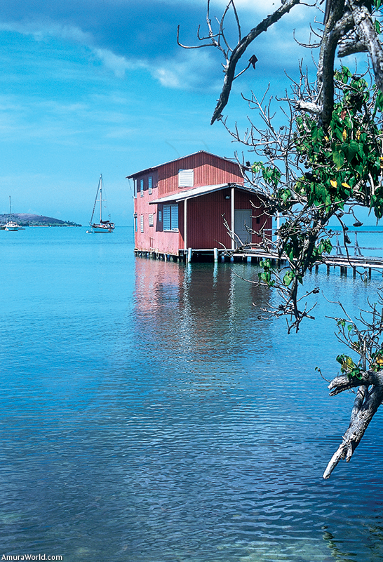
Laguna de Joyuda (Joyuda Lagoon) is a natural bird refuge and can be explored by kayak. Puerto Real (Real Port), which has several restaurants, is a small town in the depths of a mangrove and beautiful Bahía de Boquerón (Boquerón Bay) is framed by white sand beaches.
Along the Southern Coast
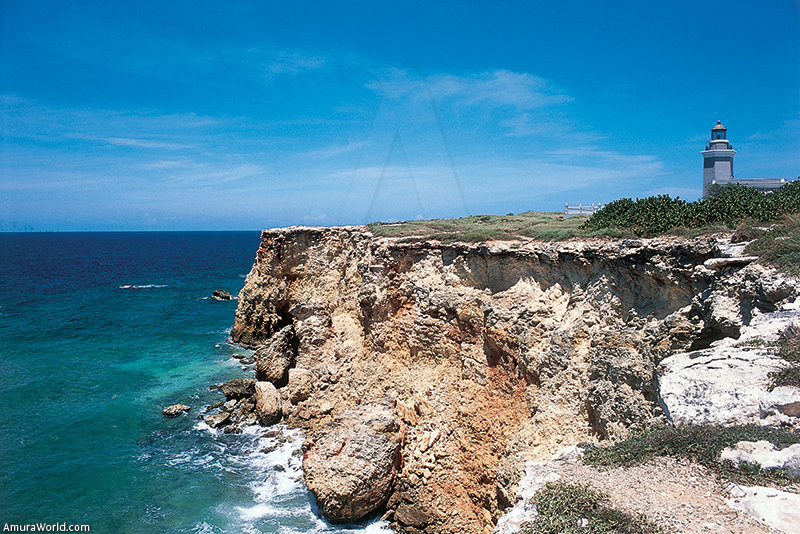
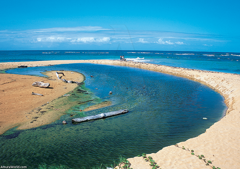
We had time to follow our route along el Combate, with calm, crystalline waters, thought to be Puerto Rico’s longest white sand beach. We passed Cabo Rojo (Rojo Cape), the highlight of which is Punta Jagüey (Jagüey Point), with a lighthouse dominating the cliffs, inhabited by gulls, and which protects heavenly Playa Santa (Santa Beach).
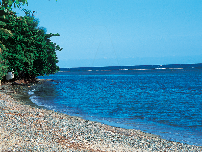
Here is Playa Santa, with its white sand and turquoise sea. This is an area where you find salt mines, because the water of the lagoons is very shallow, and strange shades of pink. Our tour continued past the southern coast, known for its coral reef, interrupted by small inlets, mangroves, coastal lagoons and a few beaches.
We anchored in La Parguera, a small town at the edge of a beach surrounded by mangroves and went by road to visit the charming town of San Germán, with its narrow streets and its central plaza that is surrounded by some of the towns most important buildings, including the Porta Coeli church (built in 1606), a series of elegant, 19th century homes, a sweet reminder of the past. The town, which is very inviting, is perfect for a tranquil stroll.
At night, after touring the mangrove canals, we explored Fosforescente Bay, where the movement of the boat and the oars in the water produce an explosion of lights provoked by phosphorescent microorganisms that inhabit the waters, resulting in an amazing spectacle of lights.
More Beaches, Mangroves and Islands…
The following day, we sail along the coat of the Bosque Estatal de Guánica (Guánica State Forest), a veritable tropical fiord 3 km (1.8 mi) long and not more than 400 m (1312 ft) wide, the sides of which are covered by a dry forest, home to 40 species of birds and 700 varieties of plants.The depth of the water makes it possible to sail without problems through this very unusual place. We followed the coast of protected Bahía de Guayanilla (Guayanilla Bay), with its mangroves and the coral coast beaten by the waves, to Marina de Ponce, which has a full range of services. We docked there in order to tour aristocratic Ponce.
Founded in the 16th century, the city prospered because of sugar cane, coffee and livestock. It became a very important city in the 19th century, adorned with elegant buildings like the impressive Guadalupe Cathedral, a theater and parks. Today it is a beautiful city, colorful and very much alive, with restaurants, nightlife and the tranquil rhythms of the provinces.
East Coast
When the sun rose, we set sail eastward, passing Playa Salinas (Salinas Beach), famous as the refuge of sailboats navigating the Caribbean, and an excellent place to anchor in case of a hurricane, thanks to a collection of small islands and canals in the deep water mangrove.
We explored Bahía de Jobos (Jobos Bay), protected by 15 keys and surrounded by mangroves. It is considered to be the best refuge for the manatee but we only saw some dolphins.
We arrived in Puerto Arroyo (Arroyo Port), which is the last of two southern plains where the large sugar cane plantations are located. There are still some buildings that are a testament to its glorious past and that mark the change in the landscape and vegetation.
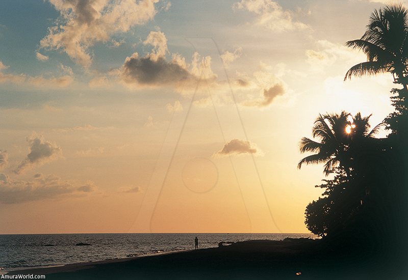
Then the mountains reach the sea, the east coast begins with jungle-covered mountains and sandy bays framed by coconut palms at the foot of the peaks where the clouds are trapped.
We pass by a series of capes, Mala Pascua, Punta Tuna, Punta Yeguas, where the Cuchilla de Panduras mountains play with the sea, creating bays and beautiful beaches, and discover Puerto Yabucoa (Yabucoa Port), situated on the estuary of Tres Ríos, where fields of sugar cane end.
Fantasy Islands
In the midst of this immense plain, planted with coconut palms, a large urban development has been established that includes a marina and golf course, two hotels, casino, banks and homes. It is called Palmas del Mar. The architecture is Spanish-Mediterranean style, the yachts are extraordinary, the people are beautiful, and it looks like a true fantasy island.
The small fishing village of Naguabo is located on a small bay, well protected by a rocky peninsula and the Santiago Key, that is inhabited by a colony of macaques.
The small town has a certain charm, with its elegant homes and its wharf, where you can breathe in the sea breeze at sundown, when the sun illuminates the rocks and along Huamacao beach.
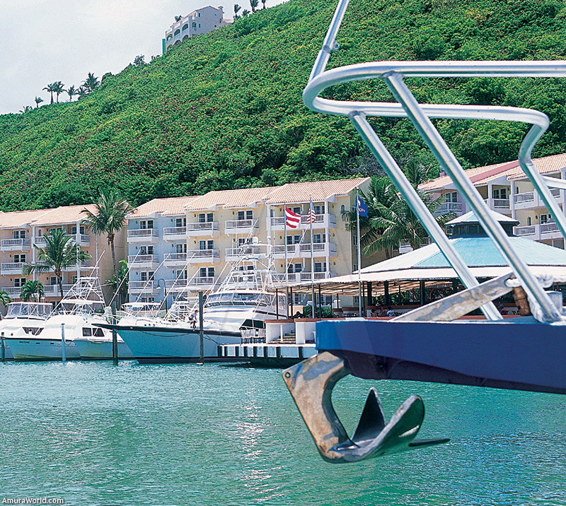
Isla de Vieques (Vieques Island) is just 10 miles from here, but we did not have time to visit it or Culebra Island. We sailed around the peninsula from the Roosevelt Roads naval base. It is one of the world’s largest bases, with a military population of 2500 and about the same number of civilians. At the end of the day we arrived at the charming, 750-slip Puerto del Rey marina, the largest on the island and perhaps in the Caribbean. The town has restaurants, shops, banks and all necessary boat services, including major repair shops.
Bordering the Island
We started our last day sailing around the northeast peninsula of the island. Both Puerto Real (Real Port) and Playa Fajardo (Fajardo Beach) have marinas. The ferry set sail from the port and along the coast are marinas, including Villa Marina and Puerto Chico, and the Wyndham El Conquistador Resort, with its hotel and its extraordinary golf course in the hills. We cross the tranquil waters of Las Croabas, protected by several islands, to sail around Cabeza de San Juan, a small peninsula that is a natural reserve, with lagoons and protected beaches, including Escondida, Seven Seas and El Convento.
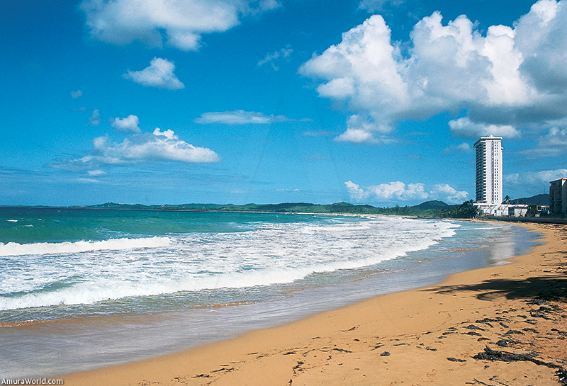
Then we came upon a whole series of beautiful beaches lashed by the strong waves of the Atlantic, protected by capes, or sheltered in beautiful, white sand bays that are framed by apartment houses and hotels.
Luquillo, with its intense nightlife, is the small Saint Tropez of the northeast coast. In Loíza Aldea there are churches dating from 1646. Once you pass Punta Cangrejos (Cangrejos Point) the coast of Greater San Juan begins, with condominiums and hotels at the edge of the sea, including Pine Grove, Isla Verde, Ocean Park, Condado, Miramar, La Concha and a complex of cozy, very popular beaches.
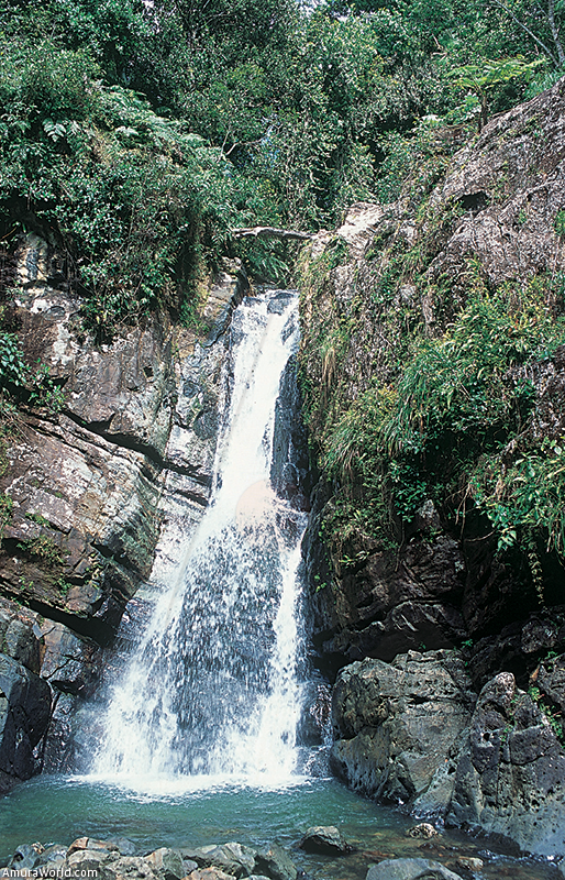
We explored the Central Mountain range in three days discovering hidden towns, tree-like ferns that climb up to the sky and lose their majestic leaves in the fog, and cascades that roar in the folds of the mountains.
From Barranquitas, an exquisite town dominated by a beautiful church on the plaza, that is adorned with a kiosk, to Maricao, a village—the queen of coffee— hidden in a small valley.
Returning to San Juan
El Yunque, just an hour from San Juan, is a mountain that is 1,049 m (3,441 ft) high, covered with its original humid tropical forest. It is inhabited by 240 different species of trees, some over a thousand years old, a thousand species of plants, 50 of orchids, 60 of birds, including several hummingbirds, and the endangered Puerto Rican parakeet (Higuaca).
It also contains nine species of sweet water shrimp, the Coquí frog, lizards, and the Puerto Rican boa, all divided among four different zones of vegetation. The types of trees change with the altitude, rainfall varies and the top is covered by the fog that feeds the moss. El Yunque is the Caribbean’s most famous national park, and can be visited along perfectly marked paths.
Puerto Rico is an enchanting island that fascinates because of its people who chat in the shade of the threshold of the houses or dance when the nights cool. The winds tell stories of the pirates who inhabited the bays, and sailing around them is an invitation to discover natural beauty, a coast that surprises after each cape.
Text: Patrick Monney ± Photo: Patrick Monney