compás int • int compass
MONTAÑAS
Las cadenas montañosas mantuvieron aislado al
pueblo tibetano, lo cual les permitía el aislamiento
ideal para desarrollar su tradición espiritual. La al-
tura media del Tíbet supera los 4,000 metros s.n.m.,
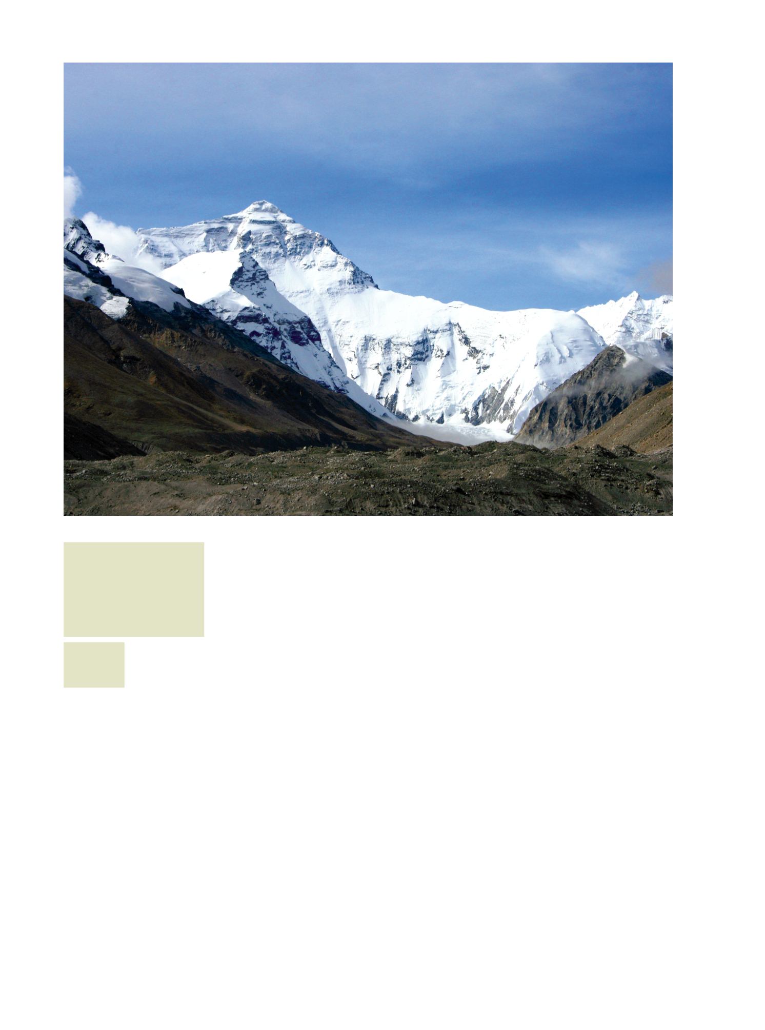
y comparte con Nepal el Everest (8,848 m.s.n.m.),
que ahí se conoce como Sagarmantha (“La frente
del cielo”) y en el Tíbet como Qomolangma Feng
(“Madre del Universo”).
Las aves que quizá se elevan a más altura sean los
gansos ánsares, que vuelan sobre el Everest a más de
9,000 m.s.n.m. Suben rumbo a la montaña hasta don-
de sus alas se los permiten, buscando una corriente
ascendente que les impulse para pasar la cima; si no la
encuentran, regresan y esperan otra oportunidad para
hacer la travesía.
GEOGRAFÍA Y ECOSISTEMA
El Tíbet histórico se extiende 2’250,000 Km2, su
elevación promedio es de 4,900 m.s.n.m. y su pobla-
ción aproximada 6 millones de tibetanos; la Región
Autónoma actual abarca 1’228,400 Km2 y su eleva-
ción promedia los 4,000 metros.
Los tibetanos llaman a su país “Pho”, palabra que
árabes y persas llevaron a Europa como Tibbat y de-
rivó en Tíbet. La tradición considera que colinda con
Cachemira al oeste, con China al este, con Mongolia
y el Turquestán al norte, y con Nepal y la India al sur.
La división política actual difiere de tal demarcación,
como se aprecia en el mapa (p. 57).
MOUNTAINS
Mountain ranges kept the Tibetan people iso-
lated, allowing them to perfect solitude to devel-
op their spiritual tradition. The average altitude
of Tibet is 4,000 meters above sea level, and it
shares with Nepal the Everest (8,848 m), which is
known there as Sagarmatha (“The front of heav-
en”) and in Tibet Qomolangma Feng (“Mother of
the Universe”) .
Some of the birds that can rise to the highest
altitudes are the geese. You can find them, flying
over Everest over 9,000 m. Heading up the moun-
tain to where their wings allow them to, looking
for an updraft that drives them to fly over the top,
if not found, return and await another opportunity
to make the trip.
GEOGRAPHY AND ECOSYSTEM
The historic Tibet extends through 2’250, 000
km2, with an average elevation is 4,900meters and
a population of about 6 million Tibetans. The cur-
rent Autonomous Region covers 1’228, 400 km2
and its average elevation is 4,000 meters.
Tibetans call their country “Pho”, awordthatArabs
and Persians carried to Europe as Tibbat and resulted
later in Tibet. Tradition believes that borders with
Kashmir to thewest, withChina to the east, withMon-
golia and Turkestan to the north, and with Nepal and
India to the south. The current political division dif-
fers fromthat boundary, as shown on themap (p. 57).
·amura·
40
1. El Monasterio
de Lhasa, el mayor
y más importante
del Tíbet.
/ Lhasa
Monastery, the
largest and most
important in Tibet.
2. El Everest, frontera
natural entre Nepal y
Tíbet.
/ The Everest,
natural border
between Nepal and
Tibet.
1
2


